Geopaths
Themed trails in Teis/Tiso
The three paths start at the Teis/Tiso Mineral Museum in the centre of the village and show the geological and botanical features that are peculiar to the area.
Geopath 1: Hike to the demonstration mine
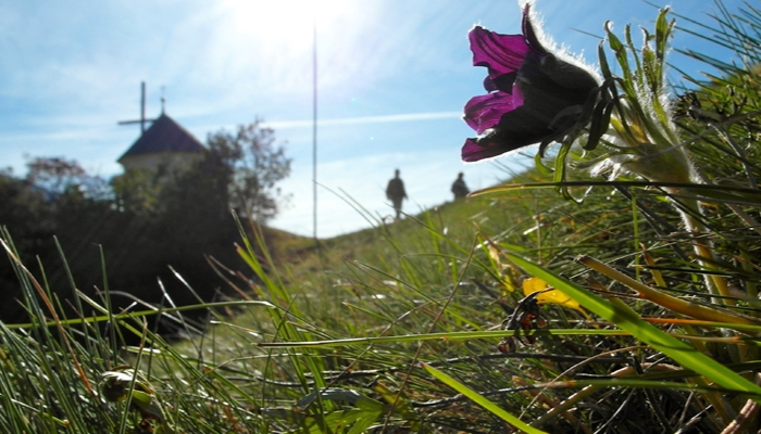
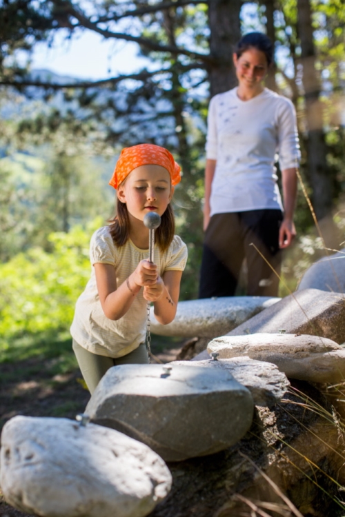
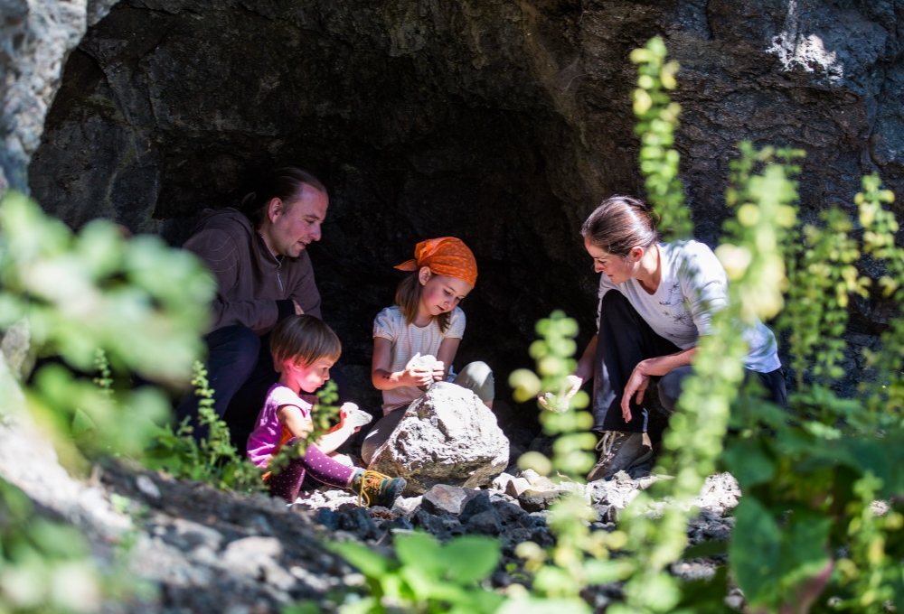
Walk across the "Vereinshausplatz" square with its drinking water fountain made of granite and a quarry stone wall made of different kinds of stone, and past the church. Continue along the level path. Interesting mineral outcroppings towards the mountains, and information panels about botany and geology. Continue until you arrive to "Lahne" (trail no. 11). At your destination you will find a beautiful view of the village of Tiso/Teis, and the Geodes of Teis exploratory drift. There are a "humming stone" and "sounding stones" you can experiment with.
Geopath 1a: On the Botanical Trail
Take the branching trail above the church and proceed along the Botanical Instructional Trail, which is equipped with information panels on trees and bushes. After about 400 m, continue over level ground to the south and across the communal meadow (steppe heath with high bio-diversity) and to the "Wetterkreuz" (weather cross) and the "Rayéta". Return via the "Raste" (meadow with a stand of old larches). On trail no. 1 proceed through dry pine forest on tuff and lava rock to trail no. 11.
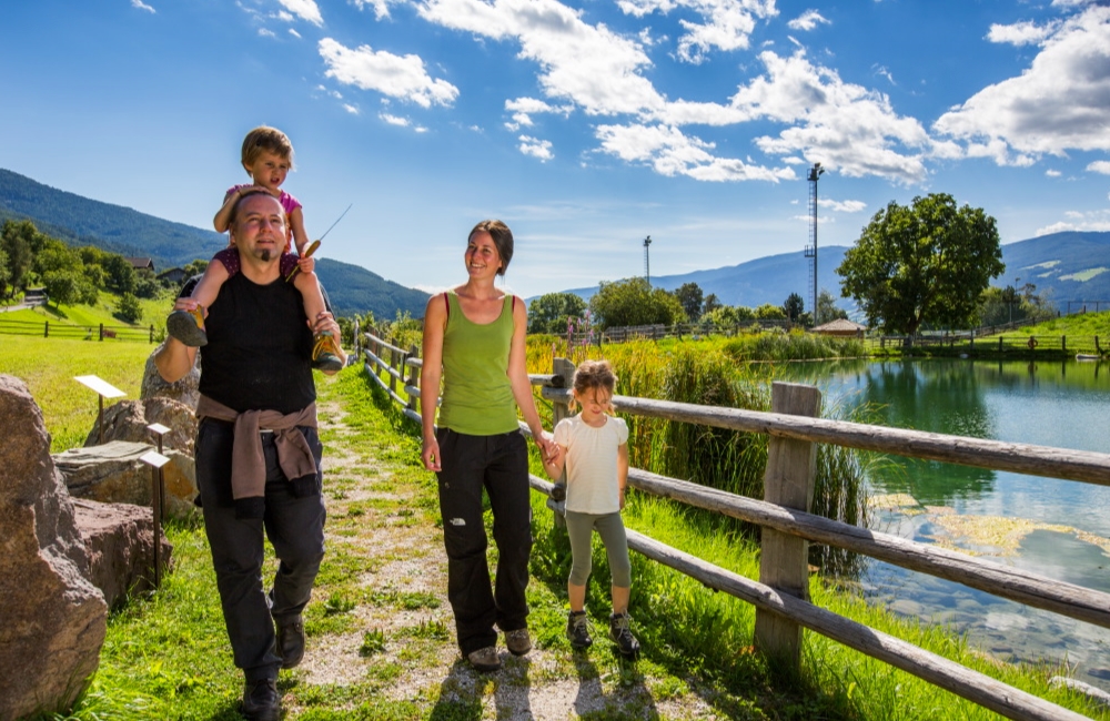
Geopath 2: "Mesner Lacke" lake circular trail
Proceed via the Brunngasse (granite block fountain with drinking water, benches and a young horn beam) to the north. You will arrive to a beautiful irrigation pond located between meadows. A circular trail (suitable for baby carriages and wheel chairs) will take you around this body of water. In three areas, there are benches where you can pause for a rest, observe the dragonflies and listen to the frogs. Boulders on the Eastern side of the pond stand witness to the area's geological history. You can also return via the "Karrner Waldele" playground and "Schelmbühl".
Geopath 3: Hill of the Holy Sepulchre
A hill rich in history, with the Holy Sepulchre Chapel and military trenches with a bunker from World War I. The view extends from the Odle/Geisler summits on to Rasciesa/Raschötz, Corno di Renon/Rittner Horn, Croce di Lazfons/Latzfonser Kreuz, Radlsee Lake,and all the way to the Zillertaler Alps. The panorama panels provide information on the surrounding settlements, mountains and the geological features of the area.
Some interesting hiking trails are waiting for you.
Geopath 1: Hike to the demonstration mine
Walk across the "Vereinshausplatz" square with its drinking water fountain made of granite and a quarry stone wall made of different kinds of stone, and past the church. Continue along the level path. Interesting mineral outcroppings towards the mountains, and information panels about botany and geology. Continue until you arrive to "Lahne" (trail no. 11). At your destination you will find a beautiful view of the village of Tiso/Teis, and the Geodes of Teis exploratory drift. There are a "humming stone" and "sounding stones" you can experiment with.
Geopath 1a: On the Botanical Trail
Take the branching trail above the church and proceed along the Botanical Instructional Trail, which is equipped with information panels on trees and bushes. After about 400 m, continue over level ground to the south and across the communal meadow (steppe heath with high bio-diversity) and to the "Wetterkreuz" (weather cross) and the "Rayéta". Return via the "Raste" (meadow with a stand of old larches). On trail no. 1 proceed through dry pine forest on tuff and lava rock to trail no. 11.
Geopath 2: "Mesner Lacke" lake circular trail
Proceed via the Brunngasse (granite block fountain with drinking water, benches and a young horn beam) to the north. You will arrive to a beautiful irrigation pond located between meadows. A circular trail (suitable for baby carriages and wheel chairs) will take you around this body of water. In three areas, there are benches where you can pause for a rest, observe the dragonflies and listen to the frogs. Boulders on the Eastern side of the pond stand witness to the area's geological history. You can also return via the "Karrner Waldele" playground and "Schelmbühl".
Geopath 3: Hill of the Holy Sepulchre
A hill rich in history, with the Holy Sepulchre Chapel and military trenches with a bunker from World War I. The view extends from the Odle/Geisler summits on to Rasciesa/Raschötz, Corno di Renon/Rittner Horn, Croce di Lazfons/Latzfonser Kreuz, Radlsee Lake,and all the way to the Zillertaler Alps. The panorama panels provide information on the surrounding settlements, mountains and the geological features of the area.
Some interesting hiking trails are waiting for you.
 "Mesner Lacke" lake trail